How to hike to Elowah Falls and Upper McCord Creek Falls
An easy way to see two different Columbia Gorge waterfalls during just one outing is to combine the Elowah Falls and Upper McCord Creek Falls hikes in Oregon.
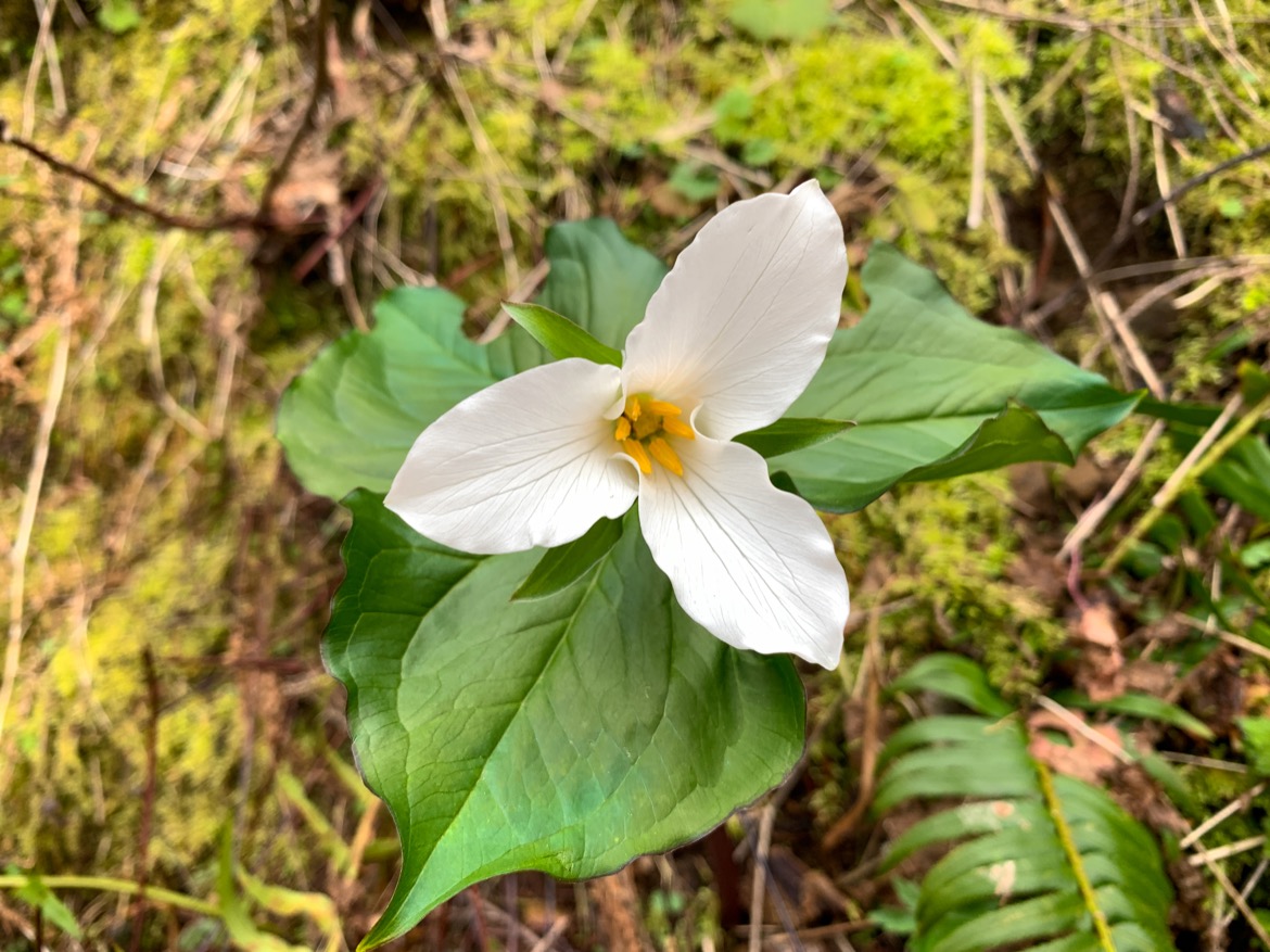
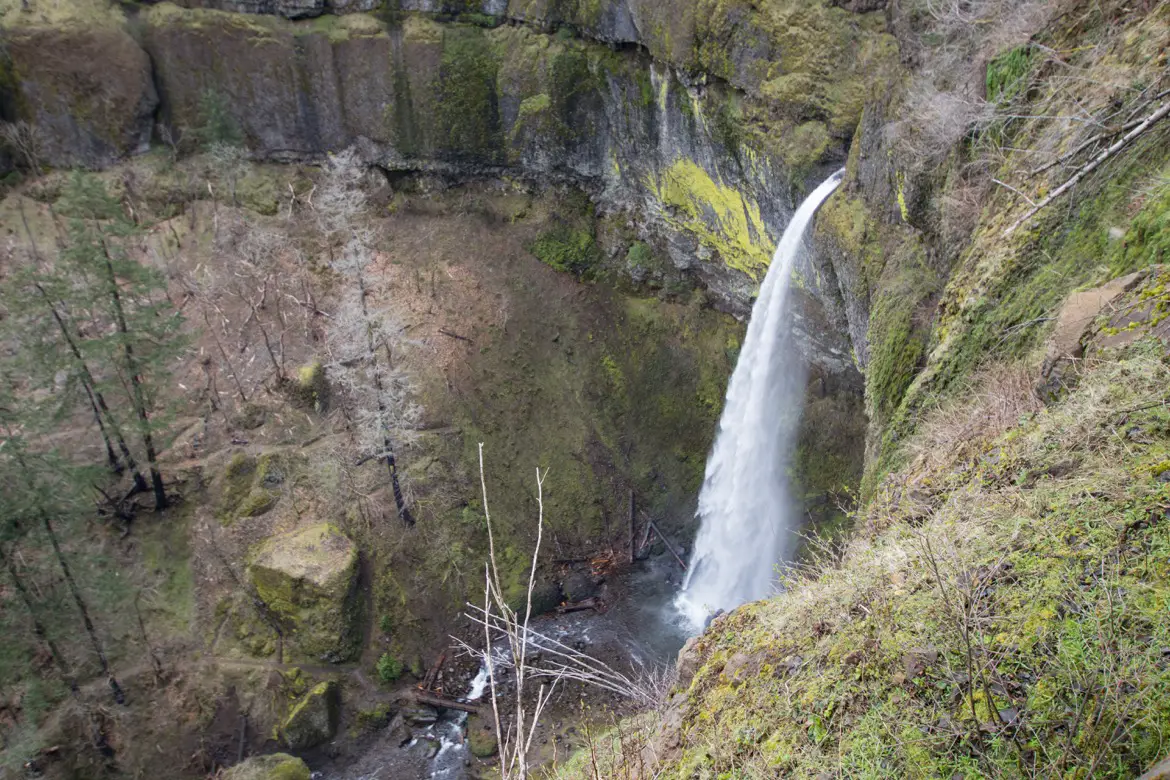
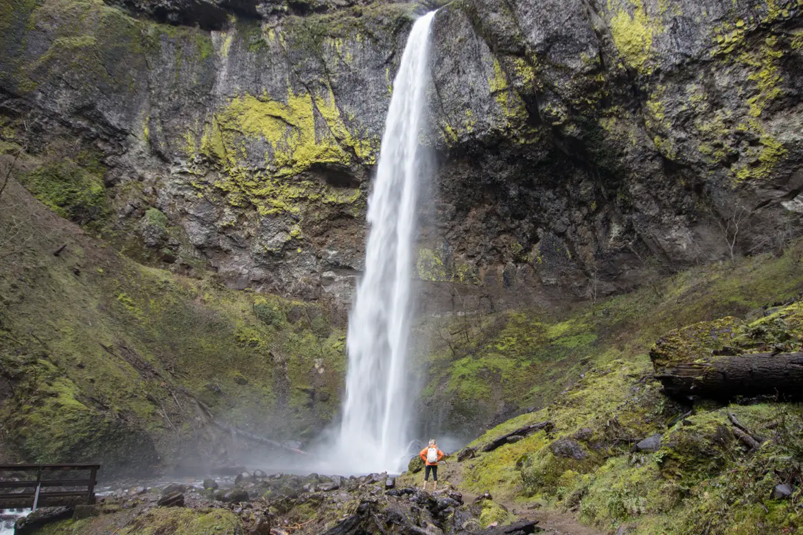
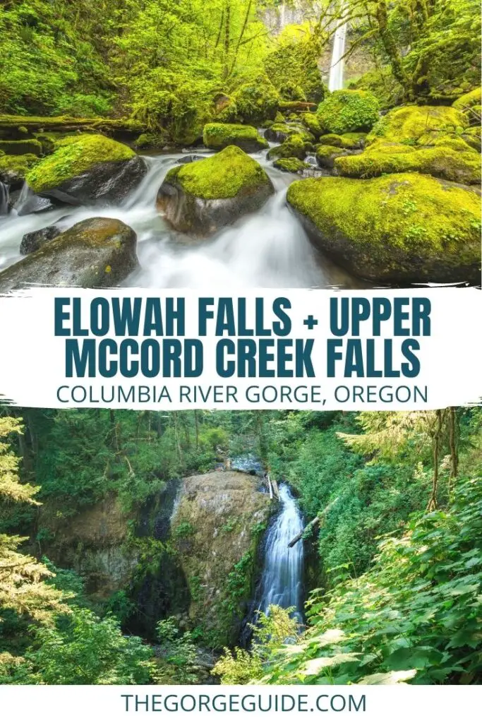
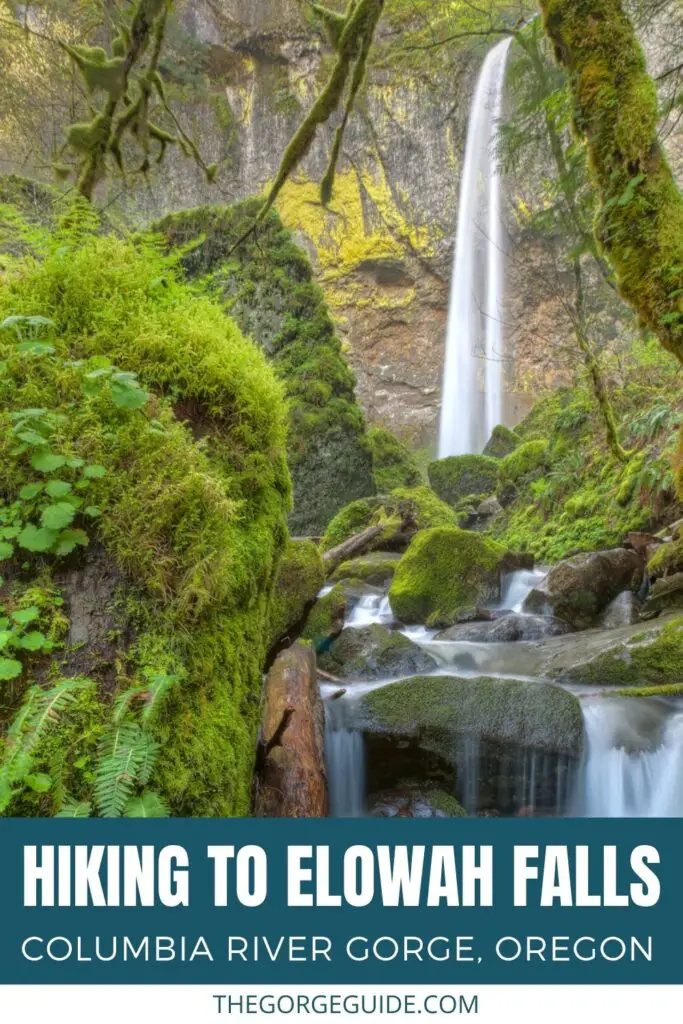
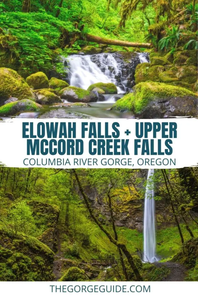
The loop is less than three miles, and features views of Beacon Rock and Hamilton Mountain across the river on the Washington side, native plants, column basalt and an opportunity to stand right under the towering, 213-foot-tall Elowah Falls.
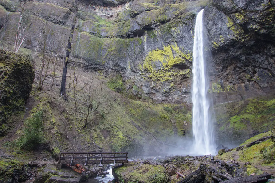
Table of Contents
The John B. Yeon State Scenic Corridor
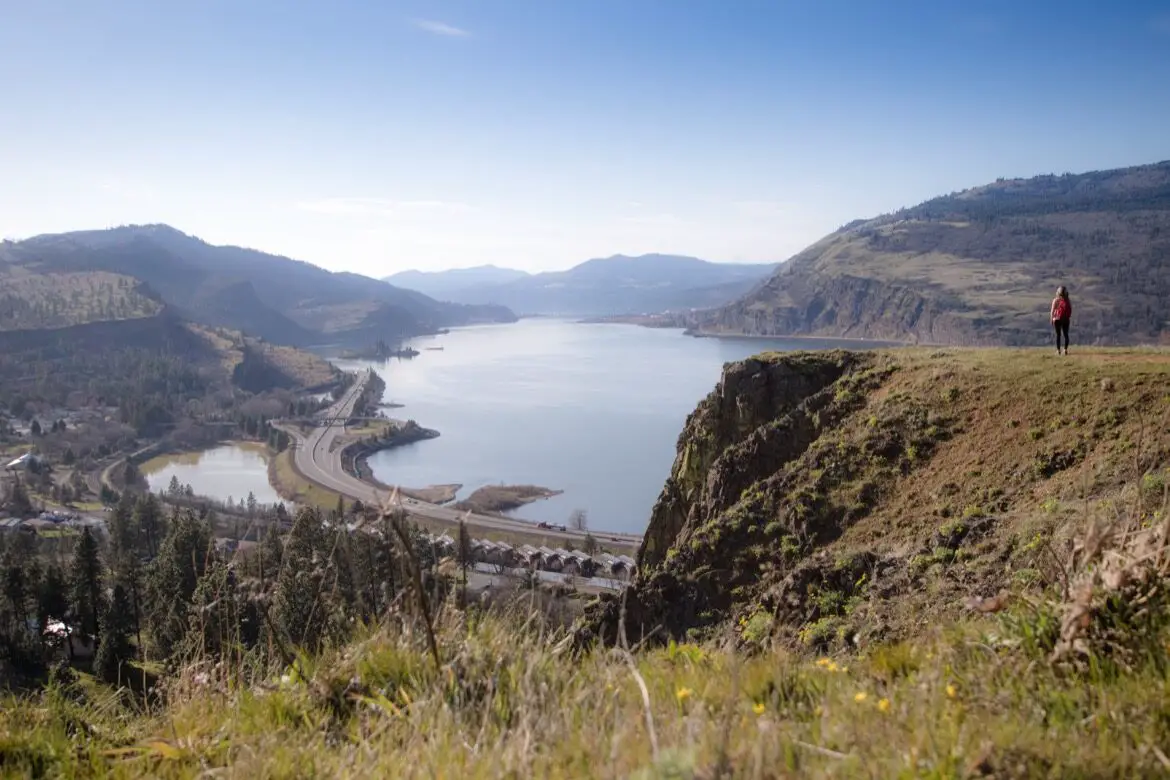
Both trails start from the John B. Yeon Trailhead just off I-84. To get there, take Exit 37 towards Warrendale and head to the well-marked lot. This spot also connects with Gorge Trail #400 and the Nesmith-Point Trail, and has a number of interpretive signs about the area.
If done separately, the hike to Elowah Falls is 0.8 miles, and Upper McCord Creek Falls is 1.1 miles.
Upper McCord Creek Falls
While seeing Elowah Falls is the highlight of this hike, head up to Upper McCord Creek Falls first. That way you’ll get the more challenging bit of the walk done first, and also get to see Elowah from above before heading back down to explore its base.
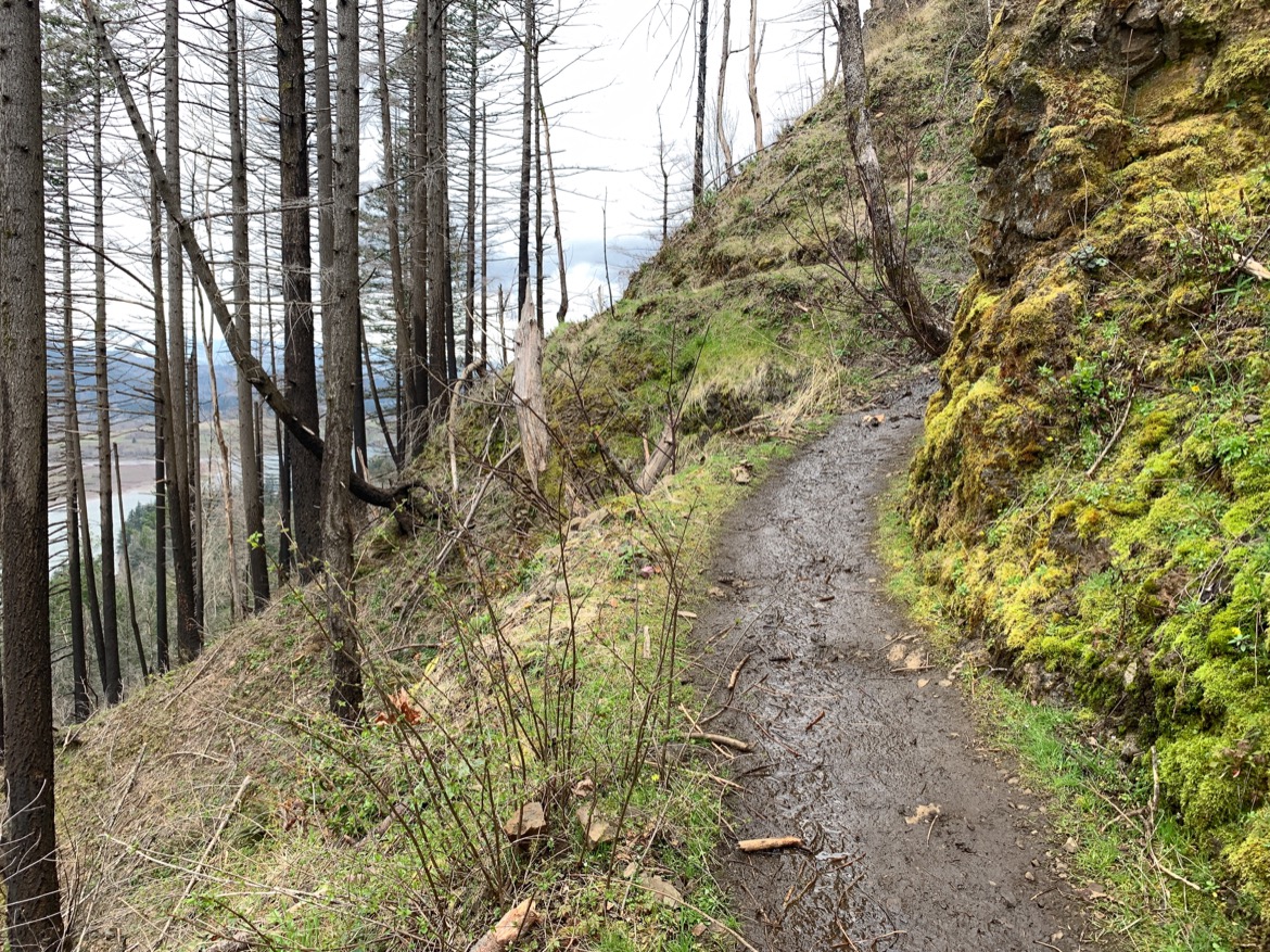
To get to Upper McCord Creek Falls, take a right when you get to the first fork in the trail and head up the hill along the series of switchbacks. Since the Upper Elowah Trail Falls trail is along the highway there’s a fair bit of road noise, and you might also see a train chugging along the tracks below.
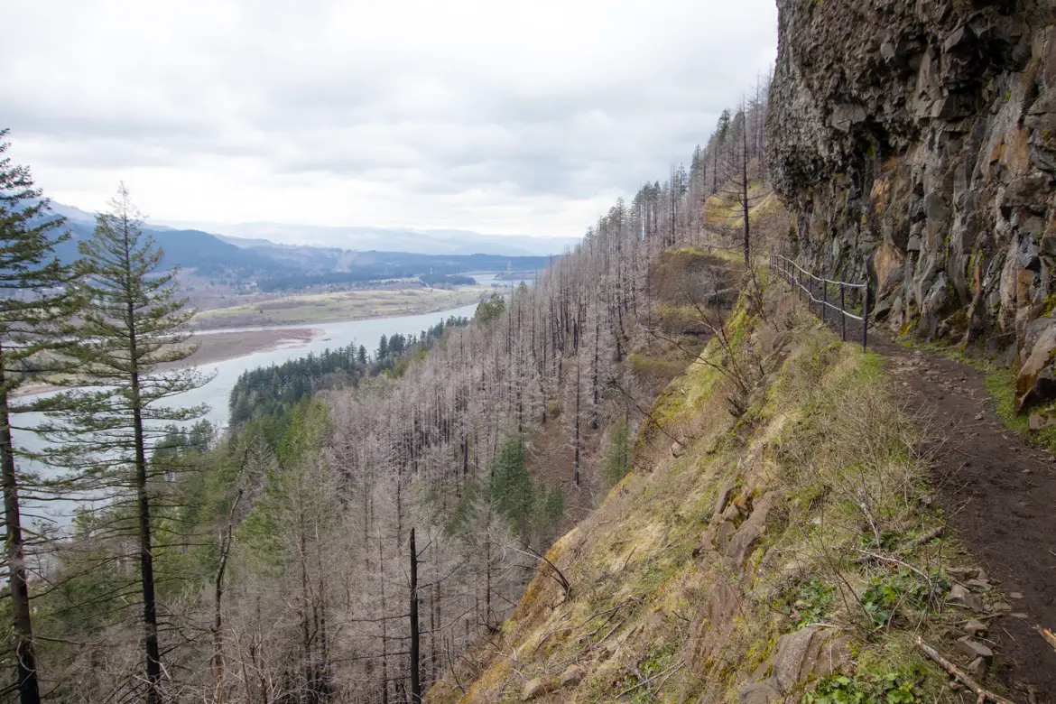
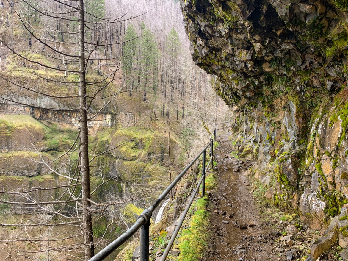
Enjoy the view of the Washington side of the Gorge peeking through the trees, as you climb about 400 feet up the narrow trail carved into a steep cliff face. At the top, there’s a flat ledge section framed by column basalt that’s constantly dripping water, and guardrails to protect visitors from falling off the edge.
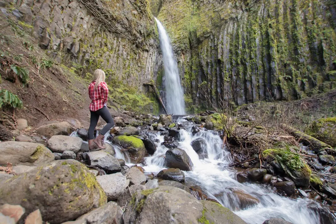
This is where you’ll get your first, birds-eye view of Elowah Falls bursting out of the canyon below.
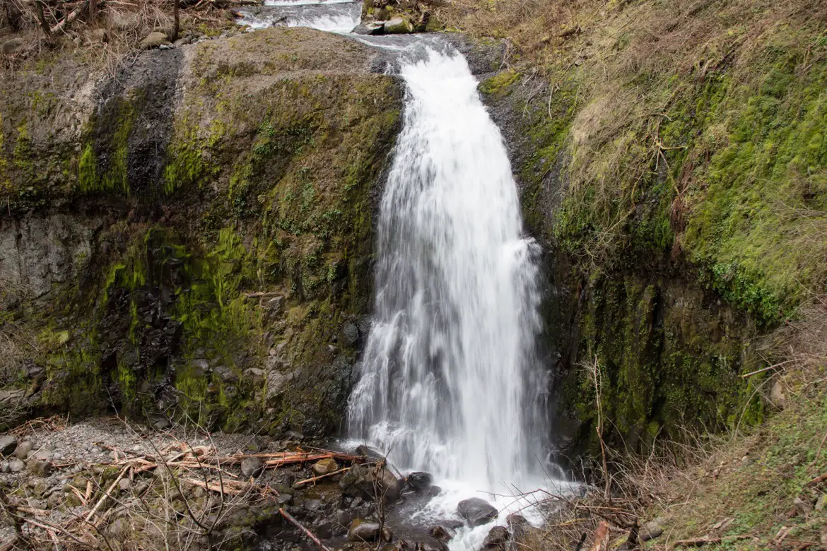
It’s only another few minutes along the trail to get to the 64-foot-high Upper McCord Creek Falls, which is surrounded by vibrant green, mossy rocks.
Elowah Falls
To complete the hike, head back down to the fork where the trail split off, and turn right towards Elowah Falls. The trail is a bit wider, and descends through a thick forest of Douglas fir.
There are a few switchbacks as you round the corner and head down towards the falls, and some steep steps marking a newer trail to replace the original one that was damaged during the 2017 Eagle Creek Fire.
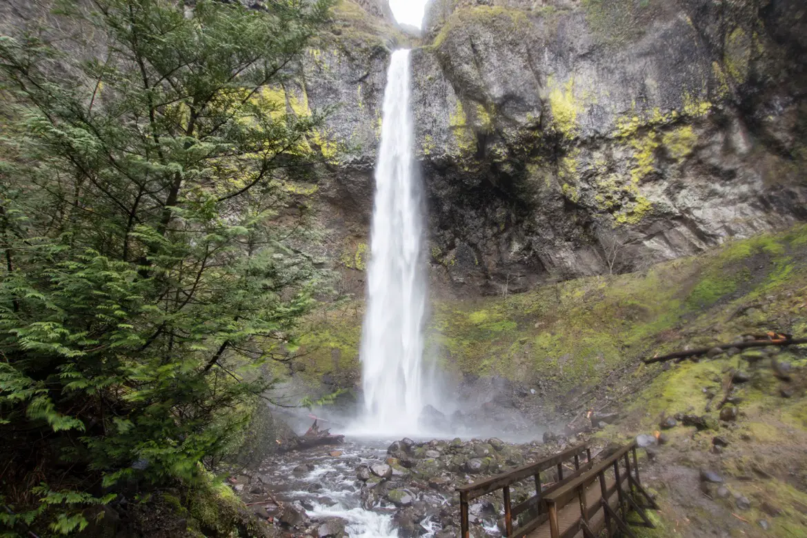
Majestic Elowah Falls soon comes into view, and on windier days you’ll feel the cool spray on your face as you approach the plunge pool below.
Head back the way you came to the parking lot, or do a loop by crossing the wooden bridge and continuing along Gorge Trail #400 for more views of Beacon Rock, Table Mountain and McCord Creek. It connects with the Historic Columbia River Highway State Trail at the freeway, where you can take a left and head back to the parking lot.
PIN TO SHARE:
YOU MIGHT ALSO ENJOY:
- The incredible Wahclella Falls trail in Oregon
- Why Bridal Veil Falls is one of Oregon’s best Gorge waterfalls
- The waterfalls in Starvation Creek State Park, Oregon
- Visiting majestic Multnomah Falls in winter
- Latourell Falls: An easy way to see Columbia Gorge waterfalls

Tamara Elliott is the travel editor and founder of The Gorge Guide, which highlights the best experiences in the Columbia River Gorge. She’s an award-winning writer formerly based in Hood River, Oregon, who particularly loves the area wineries and waterfall hikes. Tamara is also the founder of Globe Guide, which offers savvy tips for exploring destinations around the world.